

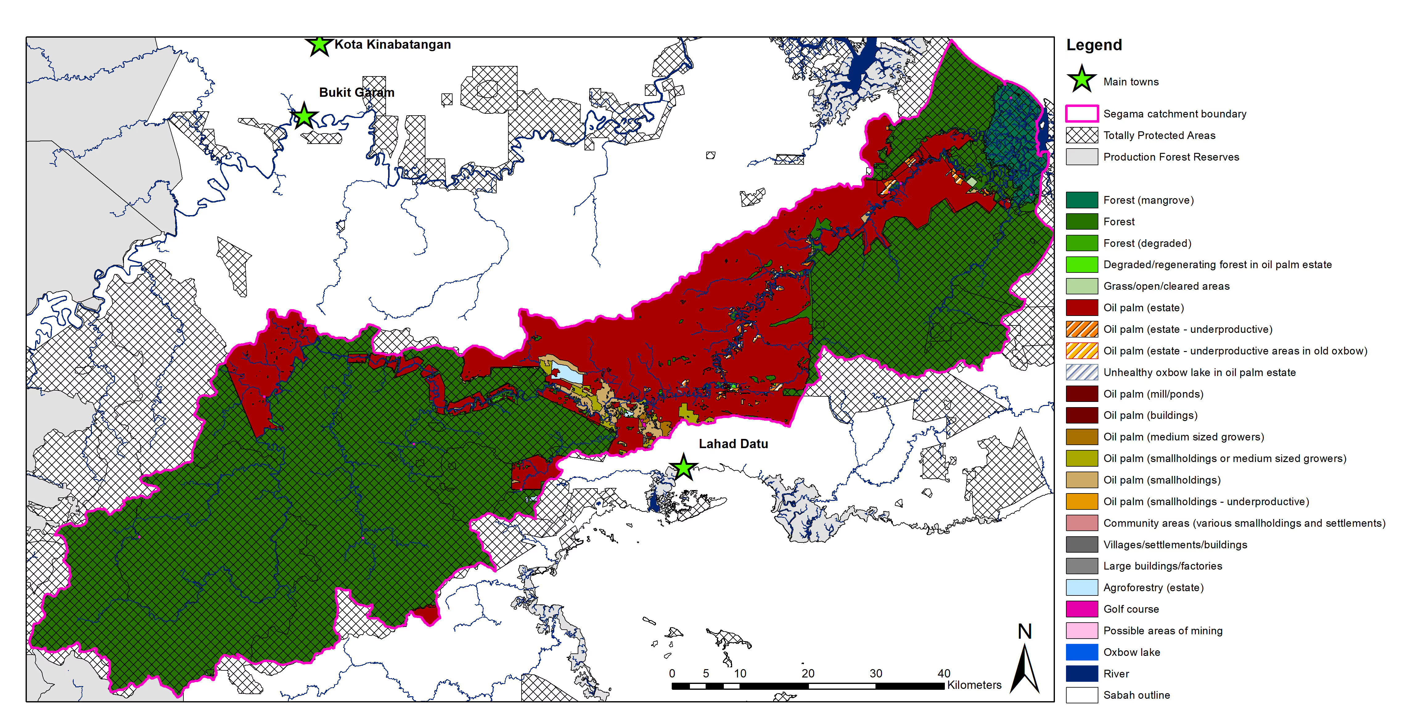
Figure 2
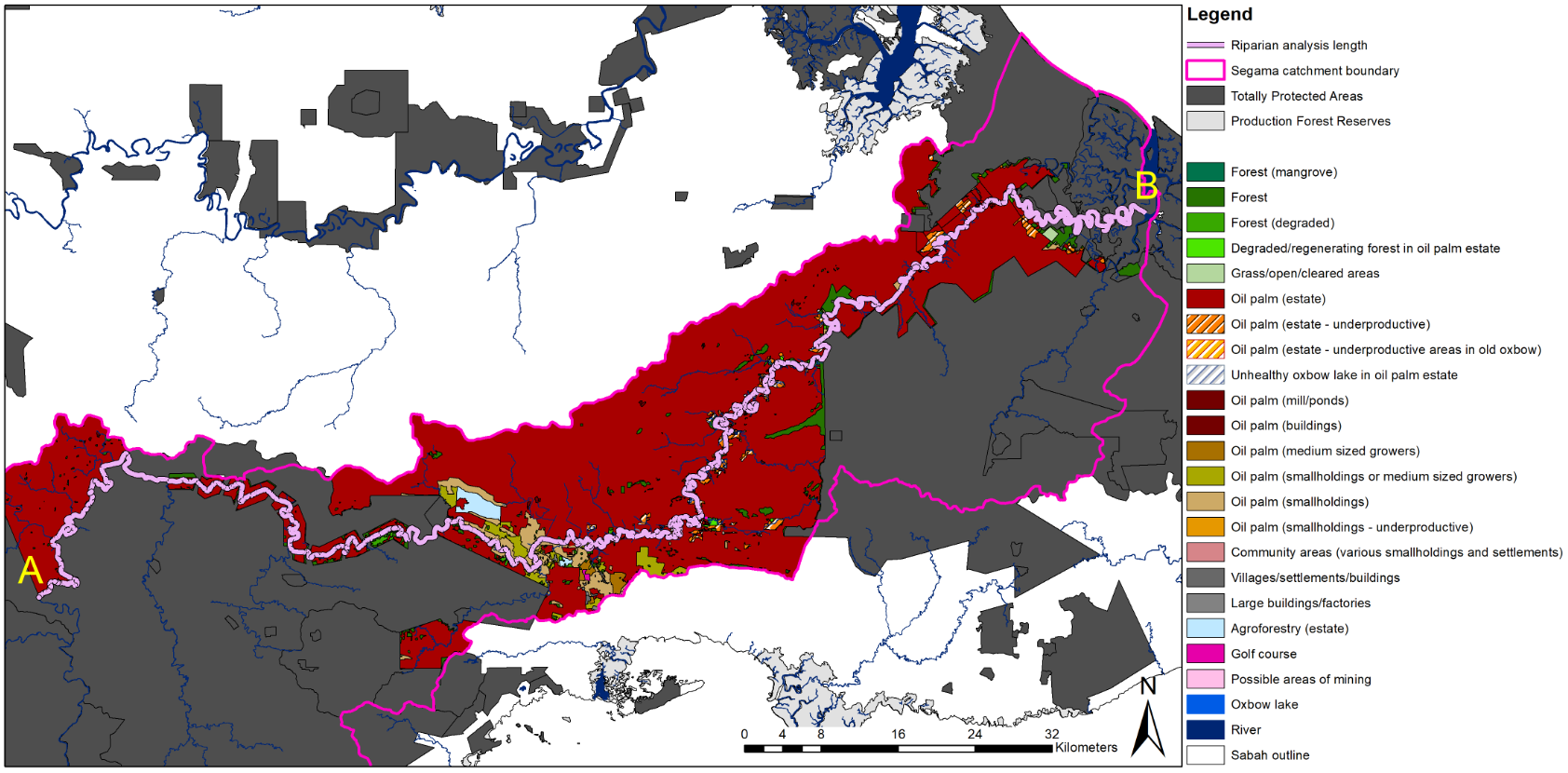
Figure 3
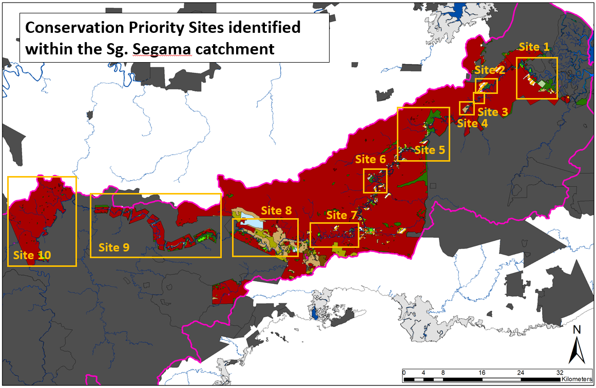
Figure 4
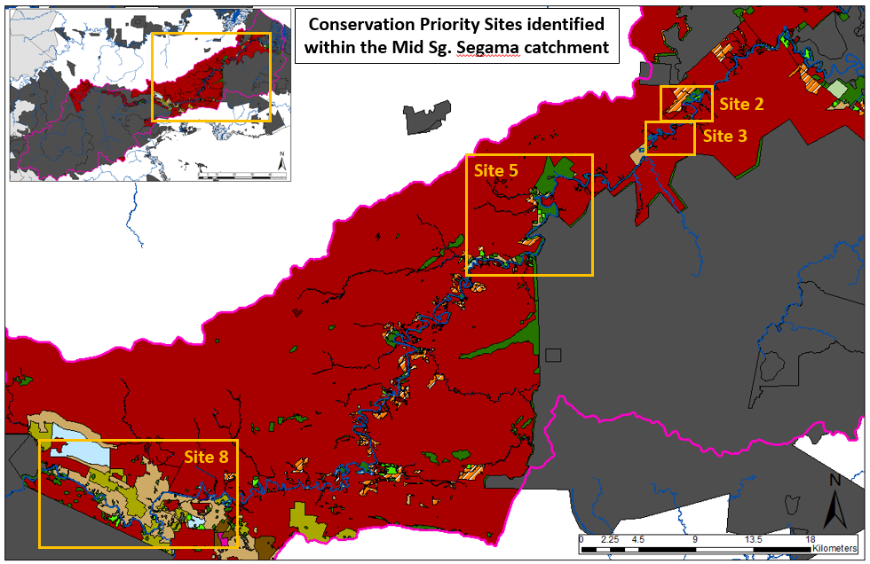
Figure 5
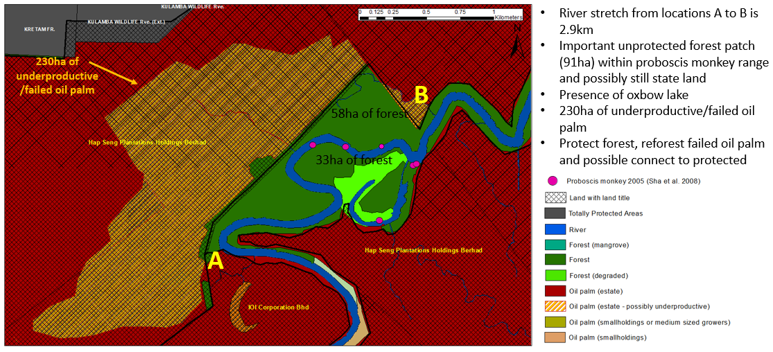
Figure 6
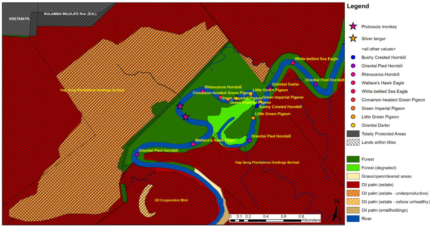
Figure 7
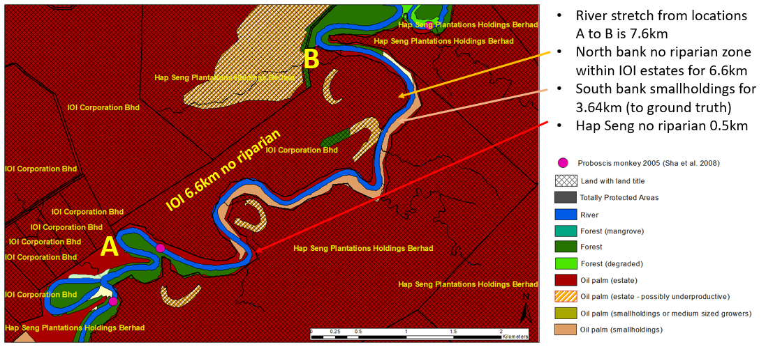
Figure 8
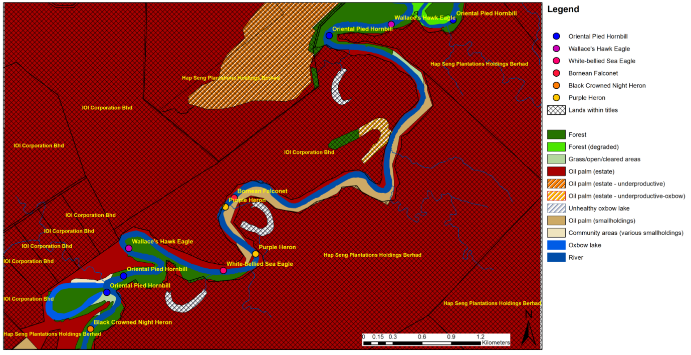
Figure 9
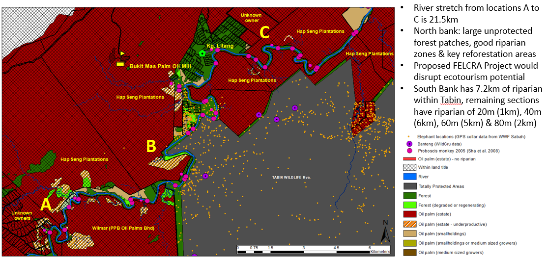
Figure 10
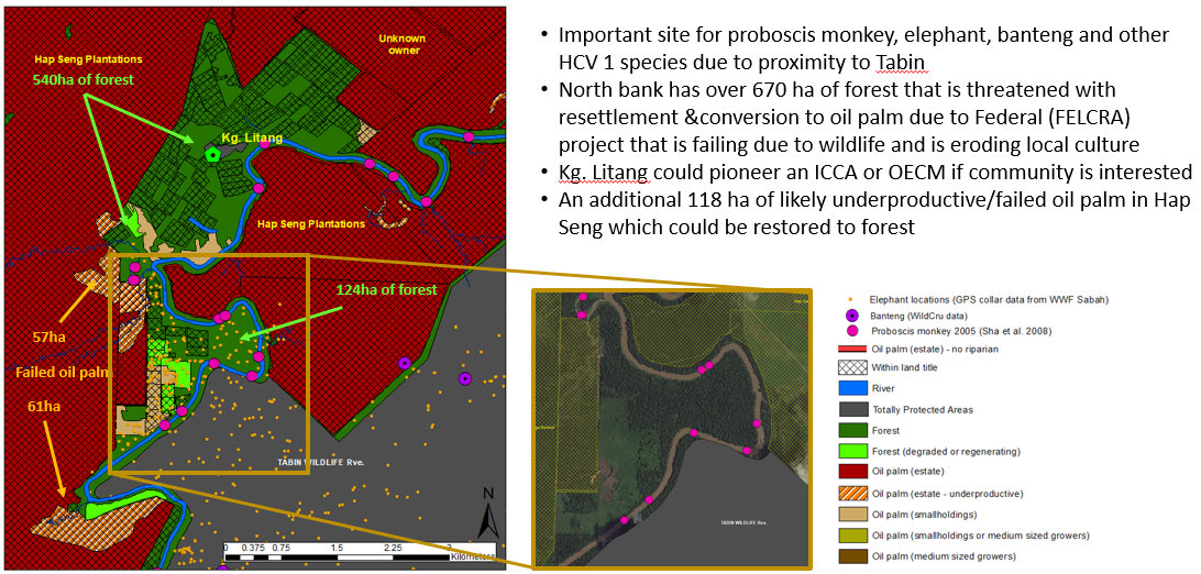
Figure 11
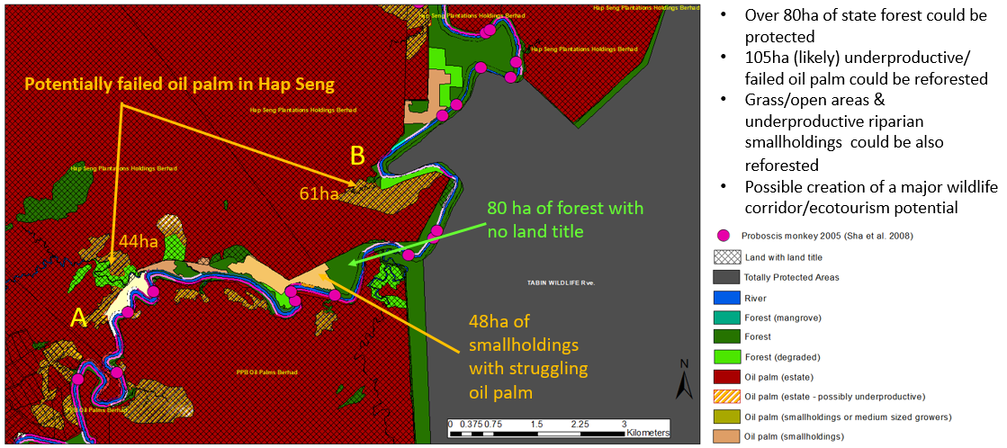
Figure 12
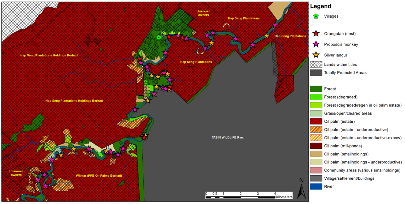
Figure 13
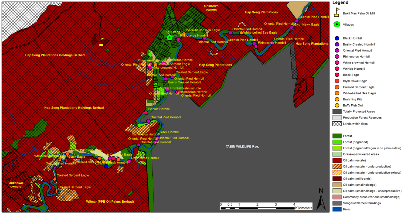
Figure 14
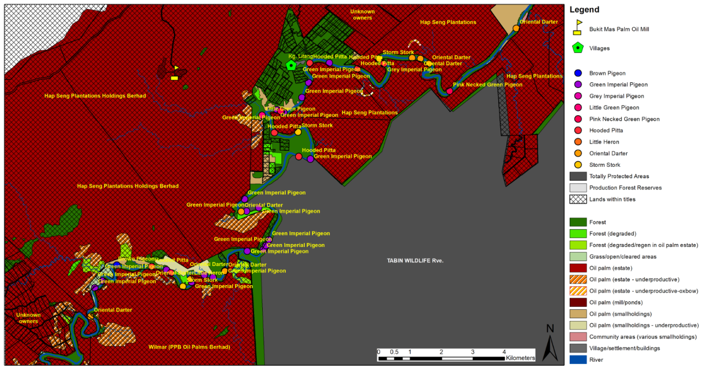
Figure 15
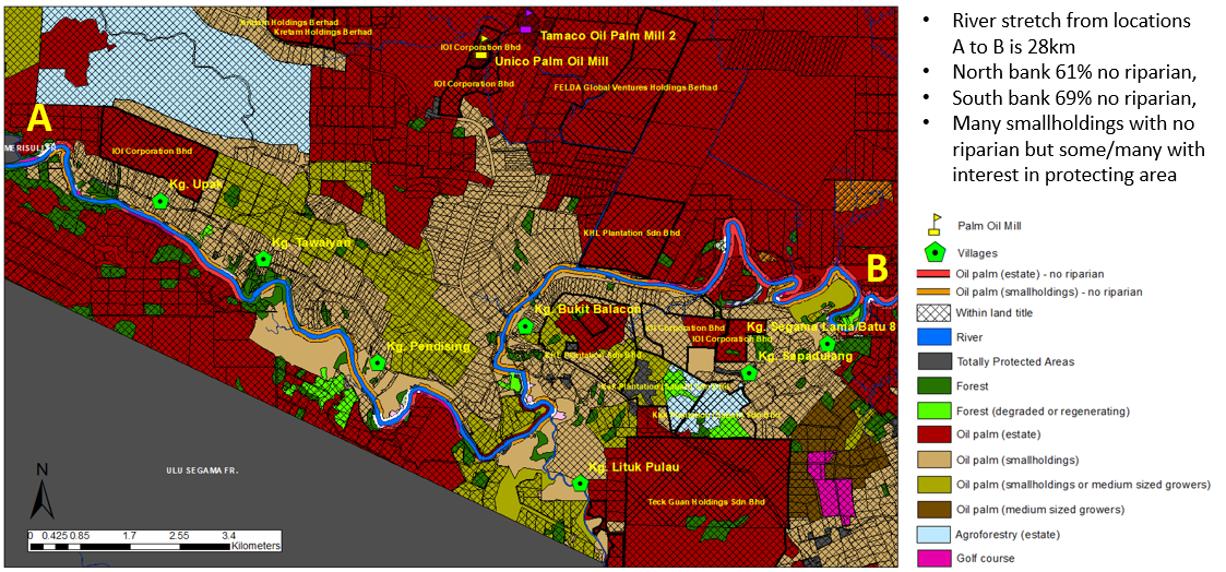
Figure 16
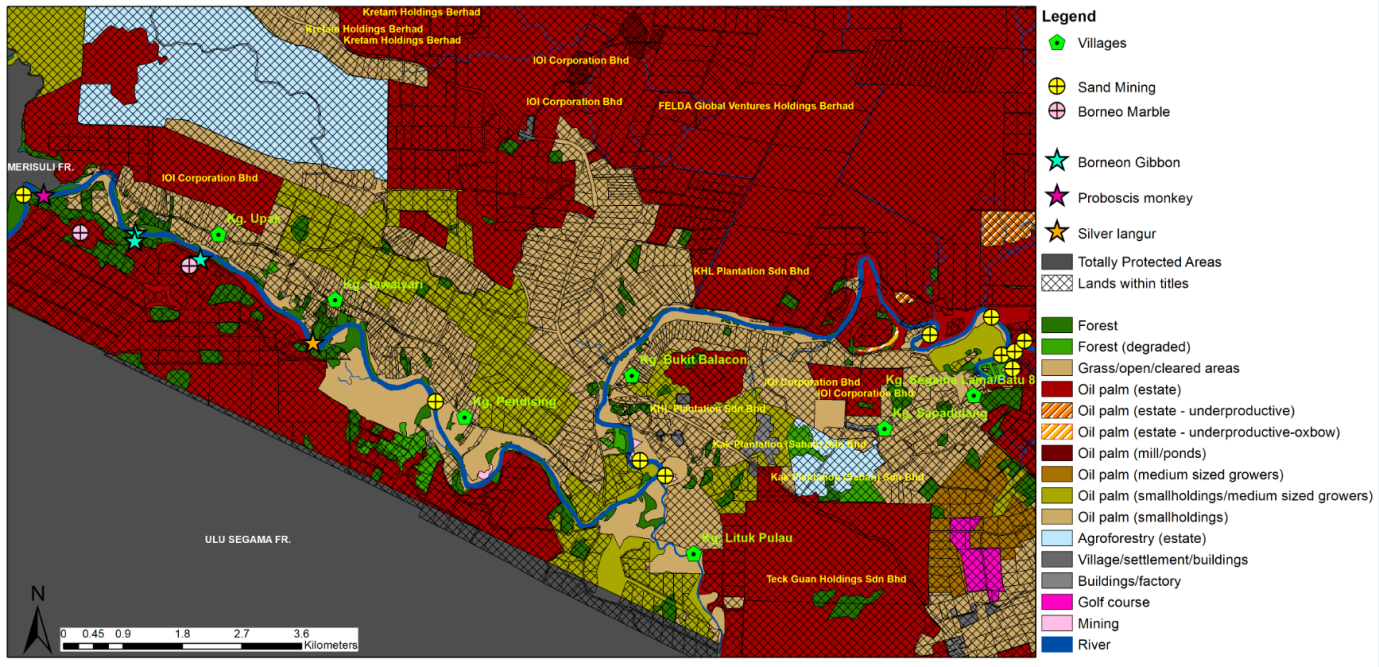
Figure 16 (Appendix Two)
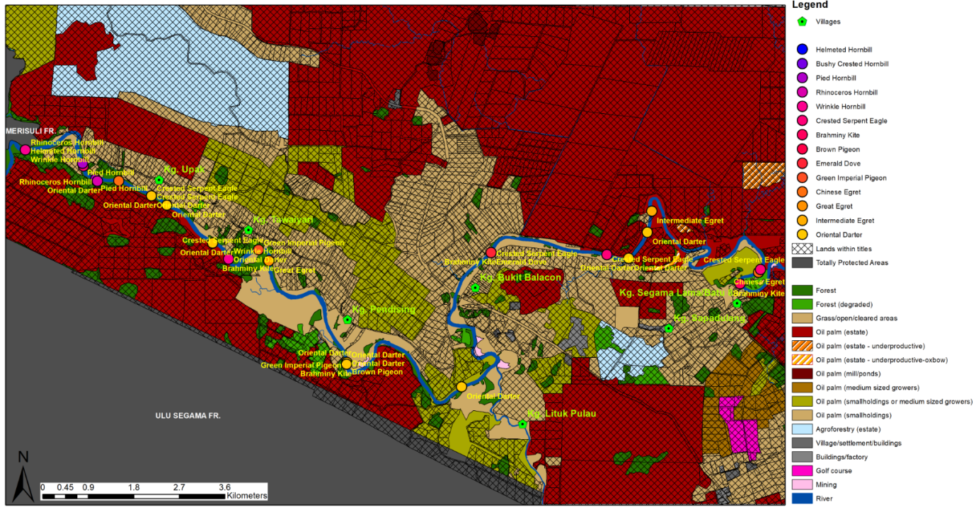
Click each to view larger image
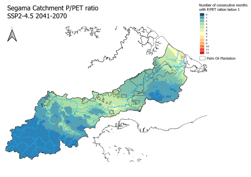
Segama Catchment P/ PET ratio (2041 - 2070)
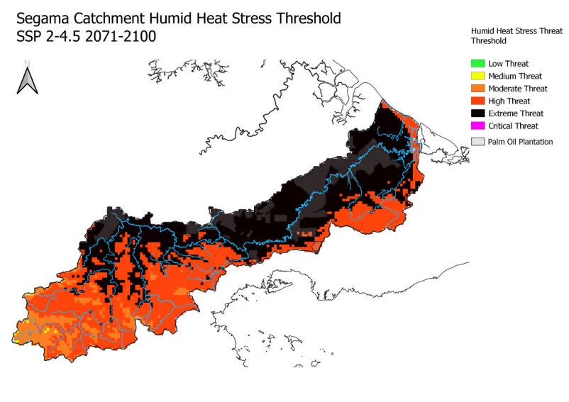
Segama Catchment Humid Heat Stress Threshold (2071 - 2100)
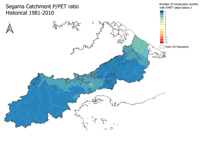
Segama Catchment P/ PET ratio (1981 - 2010)
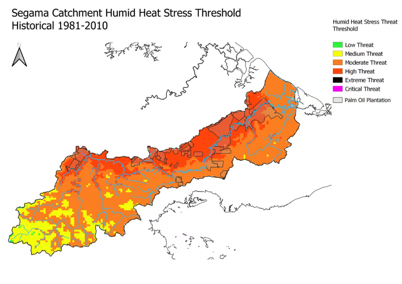
Segama Catchment Humid Heat Stress Threshold (1981 - 2010)
Live Map